|
The NAFI hotspot coverage in the late mornings has degraded with less hotspots detected. This issue is affecting hotspot detection websites around the world.
The hotspots that appear on NAFI and other websites come from satellites that pass overhead a few times a day, detecting fires as they go. The NASA Terra satellite (above) which has provided most
of the late morning hotspots, is the oldest and will soon no longer provide hotspots, likely some time in 2026. It is being allowed to drift in its orbit to save the fuel it uses to stablise
its position and some components have failed. Far fewer fires are being detected in the morning by Terra compared to previous years.
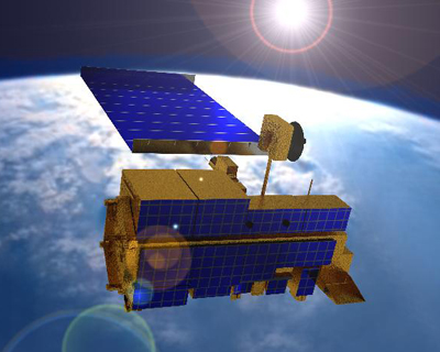
The METOP SG A1 satellite,
A new morning overpass satellite, METOP SG A1, which is planned to replace Terra was launched in August 2025 and should be able to deliver timely morning hotspot
data for Australia. However, it will take some time to prepare the satellite's hotspot sensor, set up the download operations, and the image analysis that produces the hotspots. It is hoped that
new morning hotspot detection will be available by late 2026. As this satellite carries a coarser 500m sensor compared to the 250m MODIS sensor used by Terra, we may not be able to use it for the NAFI burnt
area mapping.
The Feng-Yun 3F satellite,
Another morning overpass satellite, that in some ways is an even better replacement for Terra, is the Chinese Feng-Yun 3F satellite which is now operational. It carries a similar 250m sensor to Terra and
should be suitable for both hotspot detection and NAFI burnt area mapping. In the past there has been caution about receiving imagery from this satellite on the part of the Australian Government downlink station operators
due to security concerns. We are looking to clarify the current status of accessing this imagery.
These issues are affecting all services that deliver satellite-based hotspot information in Australia. The Terra issue is having a global impact.
You can also check the 10-minute hotspots. Use the "Hotspot Options" button on the NAFI 3 map display, or select "10 minute hotpots" in My Layers on NAFI 4, to view hotspots from the Himawari satellite which tracks fires
throughout the day. It may miss smaller fires and has coarse map locations, but it's worth checking.
|